 Brandy and I needed a mid-week hike to stay in shape and we wanted something close so we decided to hike the old Mt. Woodson Trail and a trail that parallels Mt. Woodson Trail for a short distance. We hadn’t hiked these since last spring due to the concern about rattlesnakes.
The parallel trail starts just to the south of the almost obscured dam and about .25 miles from the beginning of Mt. Woodson Trail. Last spring, it was mostly overgrown and now it is so overgrown that we briefly lost the trail. Today, there was no dew so we didn’t have to hike with wet boots, as we did last spring. We made our way through the deerweed and laurel sumac to where the trail split with a option to go to the top of the hill or around the south side of the hill. Along the way, we saw a deer near the top of a ridge to the south. We chose the more adventurous route to the top of the hill. The trail was far more discernible than before and we continued over the top and then down to rejoin the other trail.
A few hundred yards later, we rejoined Mt. Woodson Trail and continued on it to its junction with Warren Canyon Trail. We took Warren Canyon Trail and soon were reminded of the decomposing granite trail surface that made little “ball bearings” on the hard underlying rock. We very carefully made our way up the steep hill, only slipping a little.
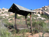
We soon came to the junction of the old Mt. Woodson Trail and took it north, up a dry wash and stopped briefly at the burned shelter. We checked the geocache that we had found last spring and it was intact. We continued to the east and suddenly lost the trail into dense brush. We knew there were some ducks occasionally marking the trail, looked for one but found none. We worked our way through the brush, climbing over boulders and looking for ducks. I had the trail loaded in the GPS but there wasn’t a waypoint close enough to help. We made several false starts, and then just decided to continue moving east hoping to find ducks or a trail. Soon, to the north about 50 yards I spotted an old, burned trail post and we headed in that direction.
When we got to the trail post, the trail was obvious. We took it back towards the point where we lost it but soon the trail just disappeared into the brush. I kept looking for a trail and didn’t understand how the trail could have overgrown so much during the late spring and summer. The next time we hike it, I’ll bring some trail tape and, perhaps, pruning shears. We returned to the east on the trail and found obvious pieces of trail, an occasional duck and dry washes which we guessed were parts of the trail. It was helpful having the boulders to climb on to spot the ducks. The trail turned to the north and then went steeply up the side of the ridge of Mt. Woodson, around boulders and over washes. My legs weren’t used to the bouldering and soon I found that they had lost most of their strength. It surprised me because I’ve hiked considerably lately, but nothing as strenuous to the legs as this. I think the high steps up the boulders and over obstacles made the difference. I paused occasionally to regain leg strength, drink water and snack. Brandy, undeterred, kept exploring. Finally, we got back to Mt. Woodson Trail and then it was time to decide whether to continue to the top with the weak legs or go back. I thought I’d rest and then decide. After a little rest and water, the leg strength returned and we continued on, past Potato Chip Rock and to the summit.
We stayed on Mt. Woodson Trail on the return and met only two hikers. I wanted a hike to stay in shape and this hike certainly accomplished that.
 We hiked our midweek hike on Ellie Lane Trail but modified our standard loop. At the bottom of the small valley after coming down from Table Rock there are two unnamed, maintained trails that connect with Ellie Lane Trail. We took the lower trail that runs parallel about a third of a mile to Ellie Lane Trail and then rejoins. We had hiked this trail only once before about two years ago finding it a narrow path through the chaparral. It has been recently maintained with the chaparral cut back to about a ten foot width. This trail is much easier than Ellie Lane Trail since this segment of Ellie Lane Trail switchbacks steeply over a hill.