Archive for November, 2008

Mt. Woodson

Wednesday, November 26th, 2008

Brandy and I left from our home intending to go past Lake Poway toward Mt. Woodson on the Mt. Woodson Trail or the Warren Canyon Trail (depends on the map one is using) to where the trail “T”s. When we got to the T, we thought we’d go on a little further. Finally, we came to a Mt. Woodson Trail sign with an arrow showing the way, and decided to see how far we could go. The trail was very well maintained but very steep with numerous switchbacks. Signs of the Witch Creek fire were everywhere.

Eventually, we came to another T and to the left we could see someone on a large (20 – 30 feet?) boulder at a peak and who was throwing rocks off it. We thought that we would go to the right because it seemed like the correct way to Mt. Woodson summit. We couldn’t see the antennas but trusted our instincts. As we proceeded toward the peak, we eventually were passed by a group of six young people. A few minutes later we saw them ahead and one person was standing at the edge of Potato Chip rock. From my perspective, the rock was so thin that it wouldn’t support its own weight. We continued on past them and soon made it to the summit. What a view! And no camera! 🙂

We stayed at the peak briefly, long enough to determine what we thought was the highest ground. There were two huge boulders that were higher still but we couldn’t find a way to the top of them. We returned much more quickly that we had ascended and I was beginning to get exhausted about a half mile from Lake Poway. I thought about calling Shirley to pick us up at Lake Poway, but as we were now walking on more level terrain I regained a bit of energy. We left Lake Poway and completed our walk back home. What a day! Enjoyable!

Statistics
Home to Mt. Woodson summit: 2.0 hours
Mt. Woodson summit to home: 1.5 hours
Elevation gain/loss: 2145 feet (Google Earth)
Lake Poway staging area to Mt. Woodson summit: 3.3 miles
Home to Lake Poway staging area: 1.3 miles
Total distance: 9.2 miles
Total time: 3.5 hours
Another coyote

Saturday, November 1st, 2008

This afternoon we took an early hike in our neighborhood instead of going to RB Dog Park.  We thought we’d go down by the creek to get a little closer to nature. We explored around the old stone houses and then turned around and went downstream. We crossed a tributary and then Brandy caught a scent. It wasn’t on the ground, but in the air and she was following it very agitated with her head held up. I saw the coyote first and a few seconds later she saw it. She pulled hard on the leash and I stopped to keep her back. She whined in both protest and eagerness to get to the coyote. I shortened the leash so the coyote wouldn’t try for dinner. The coyote was rather thin. I looked around to see if there were any others and found none. The coyote walked into the brush and we hiked back to Summer Sage, warily looking for other coyotes.

Tooth Rock

Saturday, November 1st, 2008


Tooth Rock

Tooth Rock


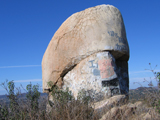
Brandy and I are looking for a Poway Adopt-A-Trail Program trail to adopt, but apparently all the trails near us have already been adopted. So, this morning we thought we’d look at Tooth Rock Trail as we’d never been on it. The first issue was determining where the trail started off Golden Sunset Lane. The street ended in a cul-de-sac with what appeared to be four private driveways. Eventually, we found a trail sign about a hundred yards up one of the private drives. Once on the trail, we found it easy to follow because we knew the general direction of Tooth Rock, even though we couldn’t see it.

The trail was generally covered with very fine dust that made little clouds as we walked. The terrain appeared to be “rattlesnake country” and didn’t look like a place we’d like to hike in the summer. We thought that we wouldn’t adopt this trail. The trail met a wider trail (a very narrow road?) and we went right toward Tooth Rock. As we walked, the dust became decomposing granite and the trail began climbing. The decomposing granite acted as ball bearings under my shoes and I struggled somewhat, but Brandy didn’t seem to have a problem with it.

We finally made it to Tooth Rock. The air was clear and we could see far and wide. After enjoying the virtual 360 degree view, we decided to return.

On the way back I missed the narrow trail at the junction of the wider trail on which we were hiking but Brandy picked it up. It was nearly hidden in the brush and could be seen easily only when next to it.

We noticed the log waterbars placed across the trail to control erosion and found about 8 places when the logs had burned in the Witch Creek fire and all that was left was the rebar stakes meant to hold the logs in place.

We returned to the trailhead, meeting only a couple of dogs barking on the other side of the fences.

Playground change

Saturday, November 1st, 2008

Due to the construction at Poway Dog Park, the small and medium dog pens have been temporarily closed and the large dog pen is extremely dusty. Brandy complained about it so we are now playing at the RB Dog Park where she enjoys the All Dogs pen.