Lost!

January 12th, 2012 18:59

We decided to geocache northeast of Ellie Lane Trail (north of Peak 2635 and east of Peak 2703) with the main purpose of getting some isolated back-country hiking that we greatly enjoy. We started at Iron Mountain Staging Area and, because we had limited time, skipped the first two geocaches which were relatively near the staging area. We could find them another time since we frequently use this staging area.

We followed Iron Mountain Peak Trail to Wild Horse Trail to Miners Trail. At the eucalyptus grove, we took the north branch of Miners Trail toward Table Rock and then at the first junction took the east branch of Miners Trail near the stream. Brandy was enjoying exploring, generally keeping ahead of me.

As we approached the junction of Miners Trail and Ellie Lane Trail immediately west of “Slickrock” (32° 59.345’N 116° 57.451’W)—lots of exposed flat rock at the bottom of a wash—I wanted to make sure Brandy knew which way we were going. There are five trails radiating from a 50-yard section of trail and it could be a bit uncertain. I called Brandy and she came almost immediately. She then went immediately out of sight with her exploring, as she usually does. I continued for less than a minute southbound on Ellie Lane Trail when suddenly I felt uneasy about Brandy. I called her again just to make sure she was with me. Silence.

I whistled. Again, silence. I heard a very faint, barely detectable repetitive clicking sound a little to the north of the trail junction so moved through the chaparral and climbed on top a three-foot high rock about fifty feet away. I listened but the sound was so faint that I couldn’t distinguish it. Occasionally, the sound of an aircraft in the distance would break the silence. Each time I waited for the aircraft sound to disappear, whistled and called Brandy’s name and then listened intently. Nothing. I took off my backpack, marked the waypoint on my GPS and moved around to try to locate the sound again. Silence.

I decided that the sound was most likely not from Brandy, put on my backpack and started hiking Ellie Lane Trail toward the north, whistling and calling for Brandy. I decided that I didn’t want to get too far from where we were last together so returned to the trail junctions.

I whistled and called Brandy’s name a few more times and then heard a double bark far down the valley to the southwest. It sounded like Brandy’s bark but thought it was too far away. I called and whistled again and heard a single bark so headed south on the segment of Miners Trail that parallels Ellie Lane Trail. When I got about a hundred yards down Miners Trail, I spotted Brandy running rapidly toward me. What a relief! As she approached I saw that she was running on three legs. Her left front leg had something black on it and I thought she had somehow hurt that leg. I quickly saw that her leg was caught in her loose collar and immediately released her leg. I have no idea what she might have been chasing that led her so far away so quickly. She apparently got her collar or harness caught in the chaparral and was finally able to free herself. I’ll be researching a small GPS unit to attach to her so I can quickly locate her—hopefully not necessary—in the future. I use SPOT for myself but that won’t work for her.

We had a very joyous reunion, and after I tightened Brandy’s collar, went back to Slickrock to pick up the use (social) trail leading east in order to find a few geocaches.
Swan Song!

March 6th, 2011 10:36

Helo

December 8th, 2010 15:37

We hiked our midweek hike on Ellie Lane Trail but modified our standard loop. At the bottom of the small valley after coming down from Table Rock there are two unnamed, maintained trails that connect with Ellie Lane Trail. We took the lower trail that runs parallel about a third of a mile to Ellie Lane Trail and then rejoins. We had hiked this trail only once before about two years ago finding it a narrow path through the chaparral. It has been recently maintained with the chaparral cut back to about a ten foot width. This trail is much easier than Ellie Lane Trail since this segment of Ellie Lane Trail switchbacks steeply over a hill.

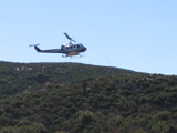
We took our usual snack break on the boulder just south of Ellie Lane Trail at the saddle with clear views to both east and west. We continued toward the junction with Iron Mountain Peak Trail. Just short of the junction, we heard a helo somewhat close and saw that it was moving very slowly. As we watched, it hovered and then landed on the helipad, kicking up a lot of dust. The dust cleared and we thought that we would hike to the helipad since it was about a quarter-mile away. However, after about a minute with the rotor still turning, the helo started kicking up the dust again and lifted off. We’d never seen the helipad in use but it’s nice to know that it’s available for an emergency.

We continued descending Iron Mountain Peak Trail meeting only two hikers on the way down.

We hadn’t hiked for two days and we both enjoyed the exercise and scenery.

Old Mt. Woodson Trail

December 1st, 2010 21:17

Brandy and I needed a mid-week hike to stay in shape and we wanted something close so we decided to hike the old Mt. Woodson Trail and a trail that parallels Mt. Woodson Trail for a short distance. We hadn’t hiked these since last spring due to the concern about rattlesnakes.

The parallel trail starts just to the south of the almost obscured dam and about .25 miles from the beginning of Mt. Woodson Trail. Last spring, it was mostly overgrown and now it is so overgrown that we briefly lost the trail. Today, there was no dew so we didn’t have to hike with wet boots, as we did last spring. We made our way through the deerweed and laurel sumac to where the trail split with a option to go to the top of the hill or around the south side of the hill. Along the way, we saw a deer near the top of a ridge to the south. We chose the more adventurous route to the top of the hill. The trail was far more discernible than before and we continued over the top and then down to rejoin the other trail.

A few hundred yards later, we rejoined Mt. Woodson Trail and continued on it to its junction with Warren Canyon Trail. We took Warren Canyon Trail and soon were reminded of the decomposing granite trail surface that made little “ball bearings” on the hard underlying rock.  We very carefully made our way up the steep hill, only slipping a little.

We soon came to the junction of the old Mt. Woodson Trail and took it north, up a dry wash and stopped briefly at the burned shelter. We checked the geocache that we had found last spring and it was intact. We continued to the east and suddenly lost the trail into dense brush. We knew there were some ducks occasionally marking the trail, looked for one  but found none. We worked our way through the brush, climbing over boulders and looking for ducks. I had the trail loaded in the GPS but there wasn’t a waypoint close enough to help. We made several false starts, and then just decided to continue moving east hoping to find ducks or a trail. Soon, to the north about 50 yards I spotted an old, burned trail post and we headed in that direction.

When we got to the trail post, the trail was obvious. We took it back towards the point where we lost it but soon the trail just disappeared into the brush. I kept looking for a trail and didn’t understand how the trail could have overgrown so much during the late spring and summer. The next time we hike it, I’ll bring some trail tape and, perhaps, pruning shears. We returned to the east on the trail and found obvious pieces of trail, an occasional duck and dry washes which we guessed were parts of the trail. It was helpful having the boulders to climb on to spot the ducks. The trail turned to the north and then went steeply up the side of the ridge of Mt. Woodson, around boulders and over washes. My legs weren’t used to the bouldering and soon I found that they had lost most of their strength. It surprised me because I’ve hiked considerably lately, but nothing as strenuous to the legs as this. I think the high steps up the boulders and over obstacles made the difference. I paused occasionally to regain leg strength, drink water and snack. Brandy, undeterred, kept exploring. Finally, we got back to Mt. Woodson Trail and then it was time to decide whether to continue to the top with the weak legs or go back. I thought I’d rest and then decide. After a little rest and water, the leg strength returned and we continued on, past Potato Chip Rock and to the summit.

We stayed on Mt. Woodson Trail on the return and met only two hikers. I wanted a hike to stay in shape and this hike certainly accomplished that.


Ellie Lane in the Rain

November 21st, 2010 13:47

We were planning on doing a moonlight hike to Iron Mountain summit this evening with a Meetup group but that hike unfortunately was cancelled. Because we haven’t hiked since last weekend when we hiked Mt. Gower and are planning to hike Tuesday to Agua Tibia Mountain summit, we needed a hike to stay in condition. We decided on the Wild Horse/Ellie Lane/Iron Mountain loop because it’s relatively close and is one of our favorite local hikes. The forecast was some rain in the late morning.

The sky was mostly overcast when we started, but we knew to expect rain later and had our 88-cent poncho with us. Brandy had nothing but I do intend to get her a raincoat since we expect to be hiking in colder rain this winter. So far, she does very well in the wind and rain.

We were about half way to Table Rock and heard someone shouting or talking loudly ahead of us. Sometimes sound carries very far in the mountains. I looked around and finally spotted a group of fifteen to twenty hikers in a row standing on the trail across the valley on the hillside almost to Table Rock. They were several of the hikers dressed in red and I was surprised that I didn’t see them before I heard them. They were so far away that I’m sure that they weren’t shouting at us but were probably shouting to a straggler in their group or to a hiker way ahead of us. Lesson is that I need to be more observant. As we continued on, we could see that the group started hiking again and were going in the same direction as we. They were soon out of sight as we went down in the valley to cross the creek and ascend to Table Rock.

We expected to be able see the hikers when we got to Table Rock but when we arrived we just saw fresh tracks on Ellie Lane. We soon heard voices but the hikers were obscured by boulders and chaparral. Imagine our surprise when we saw them, not on Ellie Lane Trail, but on the connecting trail between Ellie Lane Trail and Miners Trail. The group was standing spread out around the corner of  the connecting trail and a side trail leading to the valley back to Ellie Lane Trail. They were standing there as we worked our way down to the valley from Table Rock and back up the rocky hill toward the junction with Miners Trail. We never did understand why they were standing in one place for so long–guessing about 20 minutes or so. It was an unlikely place for a break. Could they have been lost, intending to be on Ellie Lane Trail? Now, instead of them being considerably ahead of us, they were significantly behind us.

It had started misting on us as we were leaving Table Rock and that had turned to a light drizzle as we crossed the valley and headed up the hill. Also, the drizzle came with a breeze and I was determined not to use the poncho until the last minute. We met a hiker with no apparent rain gear, said “Hi!” and continued on. Soon the drizzle turned to rain and I stopped to put on the thin polyethylene poncho. Fortunately, there was no heavy brush along the trail to rip the poncho. The poncho provided both shelter and warmth. Perhaps I needed to hike faster to generate the warmth. My hands were cold due to the wind but my core was warm and dry. Soon, we met a jogger in rain-saturated shorts, tee shirt and carrying weights in each hand.

As we headed up to the saddle, we could see and hear the hiking group as it rounded the base of the hill behind us. Soon the terrain blocked them from view. We continued to the saddle and down to the junction of Ellie Lane Trail and Iron Mountain Peak Trail. We passed several solo hikers and pairs of hikers, as well as solo joggers. It was like a freeway on Ellie Lane Trail. We’d never seen so many people and on a rainy day, no less. Some of the hikers were dressed for the weather and some had just shorts or pants and tee shirts. I just don’t understand how some of them could keep warm in the wind and rain. I was content with my poncho, although I had taken my arms out of the arm holes to keep my hands warm. I thought that the poncho was big enough and thin enough that if I fell I could still use my hands to temper any fall.

We had thought that if the weather was good enough, that we would go to Iron Mountain summit but there was enough rain that water was flowing on the trails so decided against it. Although there was water on the trails, there was no mud due to the relatively large size of the decomposed granite and the rocks.

We met two hikers with dogs on the way down Iron Mountain Peak Trail. Since Brandy was off leash and sometimes has an issue with dogs she doesn’t know, I called her to me and moved off trail as best I could, holding her harness. I was holding her with my left hand and squatting on my left foot and moved the right foot back, failing to find support. I wasn’t falling but I don’t think I would have had the strength in the left leg due to my position to lift myself with that leg alone.  I was able to quickly grab a rock with my right hand to pull myself up. I looked back through the chaparral next to the trail and saw it was about six feet down the rock to firm ground.

While we were returning to the car, as it was still windy and raining, I was trying to decide how to get Brandy in the car without mud on her feet. I couldn’t see any good way but thought that if I had parked closer to the restrooms that I could have put her in one, got the towel from the car, cleaned her and then carried her to the car.

When we got to the car, I could hardly get the key out of my pocket because my fingers were so cold. I could hardly move them and they had no strength. I just opened the door and let her get in the car, mud and all. Then, I tried to clean her a little but I needed to get out of the rain and wind, so I just gave up.

In the process of getting both Brandy and myself into the car, a considerable amount of rain blew into the car but I’m sure it will eventually dry out.

Despite the wind and rain, it was an enjoyable hike. I’m finding out that hiking in the rain isn’t as formidable as I had thought.

Black Mountain (Ramona)

October 30th, 2010 21:21

(photo credit: Linda) The forecast this morning was 30% chance of rain showers so my friends and I decided to go. We were going to hike Black Mountain Truck Trail from its junction with the Upper Santa Ysabel Truck Trail. My friends offered to give me a ride in their 4WD, since it was questionable whether my car could navigate the USYTT. We started shortly after dawn and immediately met a hunter in a bright  international-orange jacket and a matching cap. He advised us that there were many hunters in the area. We briefly considered his warning and decided to hike. As it turned out, we never heard a shot or saw another hunter.

At sunrise we could see a bit of color over the hills, but, unfortunately, because we were about 1000-2000 feet below the peaks, couldn’t get a good view of the actual sunrise. We continued up the road, periodically looking over Pamo Valley. Soon it began misting and shortly thereafter we decided to put on our ponchos. I’d never before used one, but it was perfect for this situation. It was an “emergency” poncho that I have always carried made from what I believe is thin polyethylene and fit well over my daypack. It would not have worked well on a narrow trail with foliage or in a strong wind. It kept me warm and dry. I had been thinking of purchasing a rain jacket, but since this worked so well and also covers the daypack, I will now purchase a durable poncho plus a replacement “emergency” poncho.

We continued in the rain/mist to within a mile of the peak when we saw that Brandy’s friend, Ruca, was shivering. We stopped, deciding whether to continue or return. Ruca huddled shivering, curled into a ball against some foliage, thus we decided to return. My friend had a pouch for Ruca so he put her in the pouch and we returned, hiking in the wet clay, sometimes slipping, sometimes lifting gobs of clay on our boots. We were thrilled at times to be walking on decomposed granite. Brandy didn’t appear cold and was exploring along the trail as we descended. However, I will also purchase a rain jacket for her to protect her in colder weather, in case she needs it.

It had quit raining by the time we got to the 4WD. The parking area that was dry when we started was now a mud field. We cleaned our gear, dogs and shoes as best we could and got into the vehicle. I found another use for the poncho – a floor mat that would keep the water dripping from my pant legs, mud from my boots and mud from Brandy’s feet off the floor. We returned to Pamo Road on USYTT, periodically slipping on the mud as though it were ice, staying away from the steep dropoff along the road.

This is our second uncompleted trip. We will schedule both El Capitan (El Cajon Mountain) and Black Mountain (Ramona) again this fall.

Ellie Lane Loop

October 29th, 2010 17:21

We decided to hike Iron Mountain/Wild Horse/Ellie Lane/Iron Mountain loop because the weekend forecast was some rain and we didn’t want to eliminate the weekend exercise. Although I’ve done this hike many times, this time it was more difficult than normal, perhaps because I wasn’t hydrated. We had to pause several times on Ellie Lane to the saddle for me to catch my breath. I was so happy to reach the saddle and rest on the boulder just south of the trail where Brandy and I ate our snacks.

I took my SPOT out of the net pocket in my daypack to send an “OK” email message and then set it down on the pack so I could tell when the message was sent. As we were preparing to go, I picked up my daypack and heard the thump, thump, thump of the SPOT as it bounced down the boulder and into the short chaparral. Fortunately, I saw about where it stopped and decided that if I took my normal route off the boulder, from that perspective I probably would not be able to find it so I made my way carefully down the boulder and into the chaparral. After a little searching, I found it. Fortunately, it was still working. Lesson learned—use lanyards on equipment. The SPOT could have easily fallen to a location where I couldn’t retrieve it or it could have fallen where I couldn’t hear it.

The rest of the hike was easy. We saw only one person on Wild Horse/Ellie Lane trails and three people on the way down on Iron Mountain Peak Trail.


West Side Road/Cedar Creek Falls

October 23rd, 2010 15:16

Hunting season started today. When we arrived at the Ramona Oaks trailhead at dawn, our friends were already there talking with two hunters. The hunters were going to hunt wild pig and wanted to know where we would be hiking. We were going up West Side Road to Devils Jumpoff, hoping to see the falls but not really expecting to see water. Although we had about three inches of rain in the past week, the road, which eventually turned from pavement into a wide trail, was not muddy except for one place. Brandy and Ruca were enjoying the rain-freshened terrain and were exploring far and wide. We ate lunch at our turn-around point just off the road overlooking the tree and grassy area above Devils Jumpoff. We discussed that when water was flowing we’d come back and hike down to the stream and explore the area just above the falls. We heard two shots in the distance and wondered whether the (deer? pig?) hunters had bagged their game. After our leisurely lunch, we headed back enjoying the view of the San Diego River valley along the way.

For a while, were were looking down on the trails far below us from the Thornbush trailhead to Cedar Creek Falls. My friends had another commitment and I felt like hiking some more. I thought that since the Thornbush trailhead for Cedar Creek Falls was just a couple of blocks away and we’d hiked it just before the rains that I would see if the falls were flowing. When we started on the trail to the falls, Brandy was lagging behind as though she didn’t want to go. Perhaps she remembered the climb out last week. I kept walking and soon she was her normal self joyfully exploring ahead of me.

Somehow I got off-trail and had to bushwhack down to another trail I knew I’d find on the extensive network of trails. I found one in a couple of hundred yards, a segment of the realigned trail being built. I continued down, down, down the steep grade to the San Diego River valley. We expected to find the San Diego River flowing but the crossing was just damp with an occasional pool in the riverbed. Cedar Creek downstream of the falls was flowing only minimally, so Brandy forded while I rock-hopped across. As we approached the falls, we could hear the cascade and knew the hike would be worth the effort. Suddenly, as we were making our way through the rock field we saw Rita, a dog we knew from previous hikes. We had met a Meetup hiking group that had hiked here as a backup hike from a camping trip they were on. We are scheduled to hike with them tomorrow at the Lower Santa Ysabel Truck Trail, which links Pamo Road with Boden Canyon. What a small world!

We ate a snack while sitting on the rocks and enjoying the view and sound of Cedar Creek Falls. Brandy would occasionally go from rock to rock exploring, sometimes sliding a bit on the water-slicked, water-worn rocks.

The sun was shining when we started but by the time we left there was a slight overcast. We headed back thinking about the climb out. We took the new trail to the north around the first peak and eventually bushwhacked, as we had done last week, to join the regular trail. We soon came to another choice of which trail to take and decided on the one that was less steep. It was an recently made trail that still had the many flags guiding the workers. After a while, the construction had stopped and the trail turned steeply uphill. After a few pauses to catch my breath, I reached the top and the trail had again terminated. I bushwhacked just a little, picked up the regular trail again and continued to the new trailhead by the water tank. I like the route out that we had just taken and, until the switchback are constructed on the other trail, will continue to take it. Apparently, there will eventually be two mostly parallel trails, one from the trailhead next to the houses and the other from the trailhead by the water tank.

We had originally scheduled to join a ~15 mile hike on the Dripping Springs trail to Agua Tibia, but felt the these two back-to-back hikes were an acceptable substitute.

Cedar Creek Falls

October 16th, 2010 15:03

We met our friends and their dog, Ruca, at the Thornbush trailhead for Cedar Creek Falls at dawn. The weather was overcast with the temperature around 65°. We were surprised to find new restrooms at the trailhead, as well as, possibly, a parking area being constructed. I was a little concerned about coyotes due to the time of day and kept Brandy on the leash for a brief time. We were intending to find the trail switchbacks that were being constructed the last time we were here. There is just a maze of trails and we found what we thought were a few segments of the new trail. The dogs were having a great time sniffing and roaming quite far from us. We heard them yip a couple of times as they were chasing (I hope!) rabbits.

The way down the last hill was quite slick and I carefully picked my way. Perhaps, I should have brought my trekking poles. I carry them in the car, but since I almost always have a leash, I think it would be too inconvenient to carry. When we cross the San Diego River this fall after the rains, I will definitely need the trekking poles.

We were surprised to hear voices as we arrived at Cedar Creek Falls, because we were so early. We met three young college students who had set up camp near the falls. They had come in last night in the dark, with one of them having been there before. We continued on a hundred yards or so to the falls. We enjoyed the view while we sat on the boulders and ate our snack. Ruca slipped on a rock and fell in an algae-filled pool. She was pulled our and cleaned up a bit, but still stunk from the polluted water.

On the way out, the campers were mostly packed up watching a scorpion where they had been sleeping. Although they pointed it out to me and I was looking directly at the scorpion,  it took me a while to see it as it blended in so well with the sand background. Brandy, of course, wanted to see where the campers had been pointing and almost stepped on the scorpion. She then started sniffing just a couple of inches away from it. She never did see it, as we grabbed her harness and moved her out of the area.

We had an enjoyable conversation with the campers for ten or fifteen minutes and then picked our way back, crossing the dry Cedar Creek several times and then crossing the dry San Diego River.

On the way back we saw a small trail off the main trail that looked like it might go around the high peak we were approaching. I decided to explore it and soon found myself on a constructed trail that looped around the peak. The constructed trail became a flagged trail that became a social trail that became a game trail that finally disappeared. I knew at that time I was near the main trail so I just bushwhacked up a hundred feet or so to the main trail. My friends were far behind, coming down the peak I had bypassed. I hiked back to meet them.

We continued on taking various trail branches, occasionally finding pieces of constructed trails and switchbacks. When the trail construction is completed, the hike to Cedar Creek Falls will be significantly easier. I have mixed feelings about that because I like the challenge of the more difficult trail. Also, that will tend to attract more people to Cedar Creek Falls. Unfortunately, even now there is trash along the trail and graffiti at the falls.

Stanley Peak

October 15th, 2010 15:07

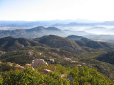
We met our Meetup group at the La Honda trailhead at Daley Ranch. We looked for other dogs but it was to be that Brandy was to be alone. As this was the first time out with this group and we didn’t know how the hikers felt about dogs, Brandy was kept under rather tight control on her leash. We took a slightly different route than on our previous hike, this time going via the Ranch House. (Image is view looking south from Stanley Peak taken on 10/2/2010 hike.)

I talked with several of the other hikers on the way to the top. Even though we started at 10:00 am, we met only a couple of mountain bikers and no hikers on our way to the  peak. This was an “advanced beginner” hike so we didn’t take the short-cut by the water tank due to, I think, the narrow trail. At the peak, we stopped to enjoy the view and I started to eat my usual snack that I eat at the peak or turn-around point of a hike. After only a few minutes, I was very surprised that the group started the descent. I rushed to gather up and store Brandy’s food, my food and camera, then put on my day pack. One of the last hikers to leave said they would wait for me just off the peak. I quickly caught up with the group, carrying my sandwich to eat on the descent.

The group didn’t have our route, so our leader would stop at the various trail intersections to direct us which trail to take. Soon, we were overlooking Dixon Lake near the dam, an obvious error. The view was superb and the trail took us down the hill and along the lake. We wound around a couple of inlets, in one place narrow and slightly overgrown.

We eventually came to a paved service road and regrouped. I looked back and saw the “No Dogs” sign on the trail we had just hiked. Strangely, there was no “No Dogs” sign that we passed coming from the other direction. We continued on the service road, then slowed to discuss which way we should have gone. As a park ranger drove towards us, I just knew Brandy was going to be an issue. Fortunately, the ranger passed us by. Then, just as I was relaxing, the ranger had turned around and was coming back. She asked how we got into Dixon Lake and we explained we had taken a wrong turn coming in on the trail behind us. She said she thought were lost, as dogs were not allowed at Dixon Lake. Luckily, we received no tickets and only a verbal warning. I’m surely happy that Brandy was  on-leash!


Iron Mountain

October 13th, 2010 15:15

We hiked Iron Mountain this morning because we needed some exercise. Brandy didn’t want to leave the parking lot, because she kept looking for the friends and their dog, Ruca, that we hike with on weekends. I kept tugging on her leash until we got to the beginning (west end) of the trees where I just gave up and took her off leash. She stood there looking back at the parking lot. I walked almost to the east end of the trees and she disappeared from sight. I waited about a minute, then started back toward the west end to see where she went. I had walked just a little bit and then saw her running to me. When she got to me, she stopped and again looked back for them. I kept walking and she finally realized that they weren’t coming and decided to go with me.

We took a breakfast break at the top at a picnic table, enjoying the view to the west. Another hiker and dog arrived shortly at the top. Brandy was lying on the table and as the dog approached her, she growled slightly causing the dog to veer off.

After we finished eating, we climbed up on the boulders at the peak, looking out to the east trying to identify the distant peaks. I took a few pictures of Brandy on top of a boulder surveying the valleys and peaks below us. Shortly, I heard soft dog growls behind me while simultaneously hearing the hiker saying something that I didn’t understand. I noticed that Brandy wasn’t close to me, quickly turned around, and, thinking that Brandy was being rude, admonished her. The hiker said that the dogs were playing and it was then I recognized Brandy’s play growl. The dogs played briefly, then the hiker and dog descended.

We continued enjoying the view for a few more minutes, then we descended. About a quarter of a mile later, we caught up with the hiker and dog as the hiker had stopped to make a cell phone call. Brandy quickly engaged the dog in play, running up and down the trail making clouds of dust. The hiker completed his call and continued on his descent. We followed a short distance behind and occasionally Brandy would run ahead of the hiker, sometimes briefly playing with the other dog. We got close enough to talk and soon we were all hiking together. Brandy’s new friend was Toby, a Mini Aussie.

We took a brief water break at the saddle, then continued down as a pack. We expect to schedule another hike with Toby and his dad in a week or so. Still, Brandy really misses Ruca.

Woodson

October 5th, 2010 21:52

We were planning to do the Mt. Woodson (yes, I know it’s officially Woodson Mountain) hike with a Meetup group this morning at 8:00 a.m. but the hike was cancelled late last evening. We decided to hike it solo since we were all set up to go. Just as we started from the upper parking lot at Lake Poway, we were passed by a trail runner. As we hiked around the lake, we kept a lookout for the trail runner to see if he was going to take Mt. Woodson Trail from Lake Poway Loop Trail. Sure enough, we saw him, now in the distance, start up Mt. Woodson Trail. I’d like to have that stamina.

When we got just past the silt retention dam on Mt. Woodson Trail, it misted for about five minutes and then quit, with no more moisture for the remainder of the hike. As we continued up the service road and I was breathing hard, I reflected on how nice it would be to be like the trail runner and just run up the trail.

We took a short break at the tree on the way up to the Mt. Woodson ridge, like we always do to enjoy the view. Even though the sky was overcast, the view was clear. I tried to trace out the old Mt. Woodson Trail but just saw a few bits and pieces of it due to the overgrowth. We plan to hike the old trail again later this year when we’re sure the rattlesnakes are all asleep.

We were about half-way up the ridge when the trail runner that had passed us at the beginning ran past us on his way down.

When we got to the peak, there were two hikers at “our” utility box where we have our snack so we sat on the rocks nearby. I fed Brandy her expected snack and then she eyed my turkey jerky. Too spicy for her, I thought and gave her a couple more tidbits of her food. She’s such an effective beggar. We finished our snack and headed back without stopping at Potato Chip Rock, where sometimes we take in the view to the north.

A short while later, I heard a voice ahead yelling, “Is  that your dog?” I couldn’t see the hiker right away so sped up quickly to be able to evaluate the situation. It was trail runner who was leery of Brandy, so I called Brandy and she came to me immediately and the runner passed us by. I knew I’d see her again on our way down. I’m just amazed at the trail runners that run up and down mountains.

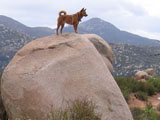
About half-way down from the Mt. Woodson ridge, I decided to call Shirley and let her know we were safe as she was worrying about the weather when I left. In the middle of the conversation, I saw Brandy on top of a very large boulder and exclaimed, “Oh! My goodness!” and told her about Brandy and wondered how she was able to get up on top. When Shirley didn’t respond, I realized that we’d lost our phone connection. I thought I’d quickly take a picture and started to get my camera from my backpack when my phone rang. Of course, it was Shirley and she had only heard the, “Oh! My goodness!” part of my monolog and was concerned. I quickly explained again about Brandy, told her I just had to have a picture and hung up. Brandy stayed on top until I had taken all the pictures that I wanted and I then had to call her down.

When we were just at the Warren Canyon Trail junction, the trail runner that had passed us near the top of the mountain was quickly overtaking us. I warned her that Brandy was ahead, but that she need not worry. As she passed Brandy who was headed back to me, Brandy turned around, caught up and ran past the runner briefly since Brandy almost always want to be in the lead.

On our way down, we saw only one other hiker who was headed up. The traffic was dramatically different today (Tuesday) than the weekend “freeway” traffic, another reason to hike during the work week.

Busy!

October 3rd, 2010 21:53

We hiked the open space around Goat Peak from Garden Road. Our goal today was to reach the intersection of the  trail where it turned due south to the tunnel under Scripps Poway Parkway and a bushwhack route to Goat Peak, about 2 miles from our trailhead.

Our trail ran past the trailhead and as we parked, we were passed by three horses and riders. They galloped up the hill that we were about to take and we didn’t expect to see them again. Brandy was off her 23-foot leash, so we were hiking at a somewhat fast pace as I didn’t need to stop for her “sniffs” and exploration. When we got to the old, burned-out house with the chimney still standing, we caught up with the riders who had slowed after just a short gallop. Brandy has become so acclimated to horses that she just ignored them as we passed them by.

We continued on, taking the side trail that we knew would eventually rejoin the main (old truck) trail. This single-track trail was considerably overgrown, but was also an access to two other trails, also overgrown, that led steeply up to ridges.

Although we have hiked this area numerous times over the last two years, we hadn’t hiked it since last May and we found that the vegetation was substantially overgrowing all the trails. It seems as though there was a growth spurt after the last spring rains.

We rejoined the main trail and continued navigating through the overgrowth, passing the point that we had seen the rattlesnake on our last hike in May. We looked for it, but it was long gone! At that time I hadn’t let Brandy off-leash and had a few minutes before put Brandy on her 6-foot leash due to my concern of rattlesnakes. The trail was a single-track about a foot wide and the rattlesnake “buzzed” just off the trail’s edge between Brandy, in the lead, and me. We both froze, then I saw it slowly retreating while rattling. Realizing that we were now safe, I quickly grabbed my camera and took a picture of the rattlesnake. Brandy seems to be smart about snakes and I’ve never known her to intentionally approach one. I’m now comfortable putting her off-leash with respect to rattlesnakes, but a little concerned about her reaction to coyotes as we’ve never had an off-leash coyote encounter. On-leash, she’s very aggressive towards coyotes, even though she’s about 2/3 their weight.

We continued to our turn-around point where we stopped for a snack. When I reached for Brandy’s snack in the bottom pocket of my shorts, I found a small tick quickly climbing up right by the pocket. It must have just got on me, judging by the speed at which it was climbing. I brushed it off, looked for others but found none. This is the first year that Brandy and I  have gotten ticks and every time it’s been in low-lying areas. I checked Brandy and found none.

We finished our snack and returned taking alternate routes where we could. We passed the junction where our earlier trail joined the main trail and about 50 yards away was another hiker with a large dog. I looked at Brandy to see her reaction and she looked but kept on walking. I then looked back toward the hiker and abruptly ran into Brandy who had just stopped. Fortunately, it was light contact. She cowered a little, looked at me, determined that it was an accident and then continued on her way.

We saw two more horses and riders across the valley on the side trail, the same one that the hiker was on. We’ve hiked this area many times and I can recall seeing just one horse and rider in all those times. Today, we saw 5 horses with riders, a hiker and a dog. Unbelievable busy! I hike this area because I “never” see anyone.


“I miss my daddy!”

August 10th, 2010 11:30

I wanted to go on a morning Meetup hike and didn’t know how the group would feel about Brandy. She especially enjoys sniffing and exploring, so I thought it best not to risk it. I walked Brandy in our neighborhood around sunrise so that she wouldn’t miss her walk. I fed her and told her, “Bye, bye”, which she understands to mean I’m leaving without her. Because it was early morning, she seemed to sense that I was leaving for a hike, not an errand. She’s normally quiet when I leave, but this time she was somewhat animated.

I had an enjoyable, relatively short hike around Lake Poway, with a side-trip to Creekside Trail in Blue Sky Preserve.

When I returned, Brandy was ecstatic. Shirley told me she had taken a video of Brandy’s reaction to my leaving without her.


Goat Peak

December 8th, 2009 19:44

We wanted to find a way from the trail network south of Garden Road to Garden Road Trail. I had seen segments of a truck trail on Google Earth but I couldn’t see a way to actually make the connection. We just got started and Brandy alerted on what I believed to be a coyote. She kept whining and pulling as I kept looking for what had her attention. Finally, I saw a dark-coated coyote about 100 meters away that was looking at us, then it started moving slowly away. It was joined by a second coyote and then the duo soon disappeared over a small hill.  We hiked to the top of the ridge near the trailhead, following it to the truck trail we had explored about nine months ago. The truck trail was so overgrown so that it virtually disappeared in several places.

Eventually, we came to a “T” and decided to explore to the right. The tracks quickly told us that it was a mountain bike trail. About a half mile later, the trail started up a narrow dry creek bed flanked by a steep hill on each side. There were several places where the creek bed went up almost vertically in about five-foot steps. I would like to have seen how the mountain bikers navigated that. We finally were able to follow the trail out of the creek bed, continued up the hill and then started down toward Hwy. 67. We hiked, with Brandy exploring the brush along the way, until we were within 0.2 miles of Hwy. 67. The trail appeared to lead to private property with a house and outbuildings, so we turned around and headed back up the hill. I set a GPSr waypoint at the peak of the trail and we headed down to the creek bed. I had to face the creek drop offs in two places to carefully back down since my boots were somewhat muddy giving me poor traction.

We returned to the “T” with the truck trail and continued on the mountain bike trail. We went over a small ridge and there it was, Garden Road Trail! We had found the connecting trail for which we were looking! The trail was now substantially less rugged than the creek  bed, with numerous switchbacks down the steep hill. We finally joined Garden Road Trail and followed it through the Sycamore Creek development  back to the starting trailhead.

I looked at our track on Google Earth and found that we had unknowingly passed within 100 feet of the top of Goat Peak. I’ve been searching for a trail to Goat Peak in order to find a geocache hidden there. Our hike was definitely a success!

Healing

December 4th, 2009 10:47

Brandy is on antibiotics until tomorrow morning and has finished her sucralfate. The sucralfate has the appearance of chalk and was given orally three times a day in a slurry with a syringe. At first Brandy hated the sucralfate but Shirley and I praised her so much that at the end it seemed she almost looked forward to it.   The syringe made it easy as we just inserted it between the teeth in her closed mouth and squirted about two cc. for each dose.

We went on a six-mile hike yesterday starting at Ellie Lane.  Just past Table Rock, down the hill and at the bottom of the valley is a granite outcropping sometimes called “slick rock”. On the east side of slick rock is the beginning of an unnamed trail marked with ducks. We have long wanted to find a connecting trail from Ellie Lane Trail to the network of trails on the Ramona side of the hills. We took the trail until we lost the ducks but continued on in the same direction. Brandy led us on the game trail until we finally came to a truck trail, that became a gravel road, that became a paved road. Weeds and brush were growing in the middle of the road, but sand bags at the washouts indicated some low level of maintenance.

Our original plan was to return the way we had come, but according to my GPSr, the nearest point on Ellie Lane Trail was about a third of a mile to the south. Brandy led us on a barely discernible game trail that eventually disappeared and at which time I took the lead up the hill. A trail to the south soon reappeared, Brandy took the lead, and near the peak I realized that we had been there a few months back, approaching the peak from the south from Ellie Lane Trail. At that time we saw a group of hikers coming toward us from the north and wondered if there was a trail that we had missed. Now, at least, we had another way to the trail network on the Ramona side. Ellie Lane Trail peak lay before us about two hundred meters away.

We picked up Ellie Lane Trail, following it mostly south to Iron Mountain Peak Trail, then down the hill to Wild Horse Trail, then Ellie Lane Trail and back to the staging area.

Brandy’s nail is obviously no longer an issue for hiking. Ellie Lane Trail is extremely rocky with sharp rocks of many sizes and Brandy, as usual, seemed not to notice.

When It Rains, It Pours

November 28th, 2009 21:04

We had a light sprinkle last night but this morning the weather was darkly overcast with rain close by. We decided to go on a walk at Lake Poway since Brandy was still recovering from her split nail and the grass would be easy on her foot. It started to rain just as we started our walk. We took shelter under the eaves when it was raining the most, then continued our walk.

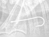
Soon, I heard  Brandy eating something and tried to get it out of her mouth but she wouldn’t let me do that. She appeared to have swallowed but then kept on mouthing for a bit. Less than a minute later, I saw something hanging out of her mouth and then my eyes focused on the swivel of a fishing leader. The line was difficult to see but I quickly understood the situation, carried her to the car and rushed her to her vet. I was careful to see that there was plenty of slack in the leader.

The vet sedated Brandy in order to see the fishhook, but was unable to see it. The vet took an x-ray (see image above) and determined that the fishhook was in the esophagus. We were sent to an urgent care facility in Escondido that was equipped to perform an endoscopy.

After discussing the situation with the urgent care vet, we left our phone numbers and went to Shirley’s sister-in-law’s home to wait for the results. About two hours later, the phone rang and we heard, “Good news!” Such sweet music to our ears!!! There was no major damage to the esophagus as the barb hadn’t caught. There was no perforation.

I picked up a groggy dog who wasn’t especially happy to see me as I had taken her to the vet so many times recently. I think I lost Brandy’s trust. She has to be kept off food for twelve hours and needs medicine—one of which can’t be in her food—for about a week. It’s difficult hearing her whimper while searching for food in the kitchen.

She’s now asleep curled up on her blanket.

“It hurts!”

November 25th, 2009 09:26

640_9937Brandy went to bed last night licking her bandaged paw. About a half hour later she woke me up and held her injured paw to me to fix. When Brandy gets a sand burr in her paw on a hike she limps to me and lifts the paw waiting for me to remove the burr to ease the pain. I felt sad that I couldn’t relieve her pain. I loved on her and she soon went back to her bed.

After another half hour, she was back at my bed holding out her paw to me again. I lifted her into my bed and for over an hour slowly rubbed her head, side and the leg above the injured paw. She repeatedly licked the paw, occasionally throwing her head back on the bed with her eyes closed. I knew she was in pain. We went to sleep after a couple of hours. Several times, I half-awakened to hear her licking and would rub her for a while to ease her pain as best I could.

Ouch!

November 24th, 2009 20:57

Shirley, Brandy and I went to Poway Dog Park this afternoon for Brandy to play with some of her friends. For some unknown reason Brandy was “snippy” at several of the dogs, which happens occasionally. Suddenly, someone pointed to Brandy and said she had blood on her. I quickly ran to her and found blood on her right front paw. Upon further inspection, I saw that she had a nail split with one piece going off at a 45° angle into the adjacent nail. She didn’t complain much when I picked her up and carried her to the car which was about a quarter mile or less away.

We immediately went to Brandy’s vet, just before closing, and she was fearful, as she usually is when she recognizes that she is going to the vet. The vet looked at her paw and then took her to the treatment room. Brandy looked back at Shirley and me, appealing for help as she was lead away.

Brandy returned with the nail trimmed and a bandage around her foot, the bandage to be worn for 24 hours. She tried to chew the bandage several times; we told her “no” and she finally left it alone. Sadly, there will be no more hiking for a while.

Iron Mountain Peak Trail

October 13th, 2009 18:14

RattlesnakeWe hiked Iron Mountain Peak Trail last in July with my niece, Anna. Even though it was early morning with a temperature in the 70s, Brandy overheated and we had to cool her off with our drinking water. We met a hiker on the way down that gave us directions to the spring, but we just couldn’t find it.

Today was in the 60s and overcast. Last evening, there was a sprinkle – the first of the season- so no longer did I have to eat Brandy’s dust! We started at the Iron Mountain Peak trailhead, undecided at that point whether to hike Ellie Lane Trail or all of Iron Mountain Peak Trail. We headed up Iron Mountain Trail to the “T”, at the last moment deciding to continue to the Iron Mountain peak.

We soon overtook a hiker with an older black Lab puppy off-leash. Brandy snarled a little when they met, as she is apt to do. Quickly, however, Brandy began running — her tail down and ears back — as fast as she could up and down the trail around the puppy. She exhibits this running behavior frequently at dog park, presumable to get other dogs to chase her. After a few laps, she approached the puppy (now we knew its name was “Cody”) and started playing.

We went on ahead, but soon Brandy stopped and wouldn’t obey, “Let’s go!” Cody caught up, they played a little and Cody continued on ahead. We swapped who was leading a few times and eventually we went on ahead to the peak.

When we were at the peak last July, the telescope was missing. Now there was both a telescope and new mailbox with a log. The first entry in the log was October 9 and it was already over half filled. We made a log entry, took a few pictures and soon Cody and Richard arrived at the peak.

Richard and I talked while Brandy and Cody played essentially at our feet. I “always” have Brandy on leash when we are hiking, but they were having such a good time playing that I thought it safe to remove the leash and give Brandy more freedom. Brandy and Cody played hard, wrestling in the dirt and chasing each other, all the time staying somewhat close to Richard and me.

After a while, play was over when Richard and Cody descended and Brandy and I ate a quick lunch at the picnic table. We then took our last pictures and headed down.

Richard had told me how to find the spring, and with his accurate instructions, I found the spring on the way back. I marked it on my GPS so I could put it on our trail map for a future hike. The spring is roughly 0.15 miles up the mountain from the helipad spur trail. Brandy took a cooling dip and then we continued down the mountain.

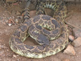
There are  two porta-potties side-by-side at the Wild Horse Trail junction. I stepped inside, letting the leash go through the doorway, and closed the door when I heard Brandy saying, “Grrrrrr!” I opened the door and saw her looking at the ground while growling. She does that, sometimes at bugs and sometimes at leaves. I decided “bug” and shut the door, holding the leash. I could hear Brandy continuing to growl. When I opened the door, Brandy was still growling and then I heard, “zzzzzzz!” right next to me. Under the threshhold of the next porta-potty was a coiled rattlesnake! We were so fortunate that I picked the right porta-potty and that Brandy has good snake instincts.

I looked up and down the trail to see if there were any hikers; there were none. I then found a branch to poke at the snake to get it to move. The snake stayed motionless as I poked at it a bit, so I just left it alone, hoping it would go on its way before any other hikers come along.